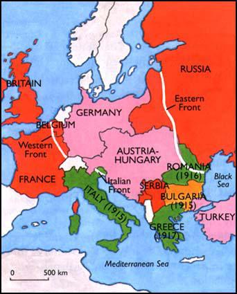
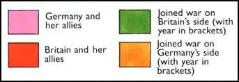
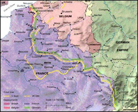
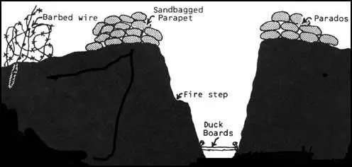
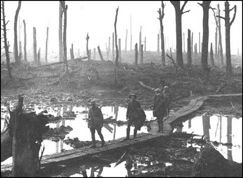
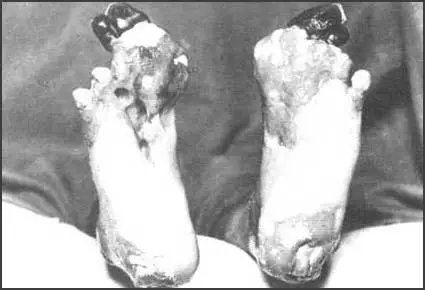
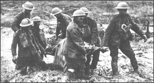
Spartacus Educational > Drawings and Maps for First World War Drawings and Maps for First World War Britain in the 6th century Trench System Cross-section of a front-line trench Australian soldiers walking on duck-boards at Passchendaele A photograph of a man suffering from trench foot Stretcher-bearers on the Western Front